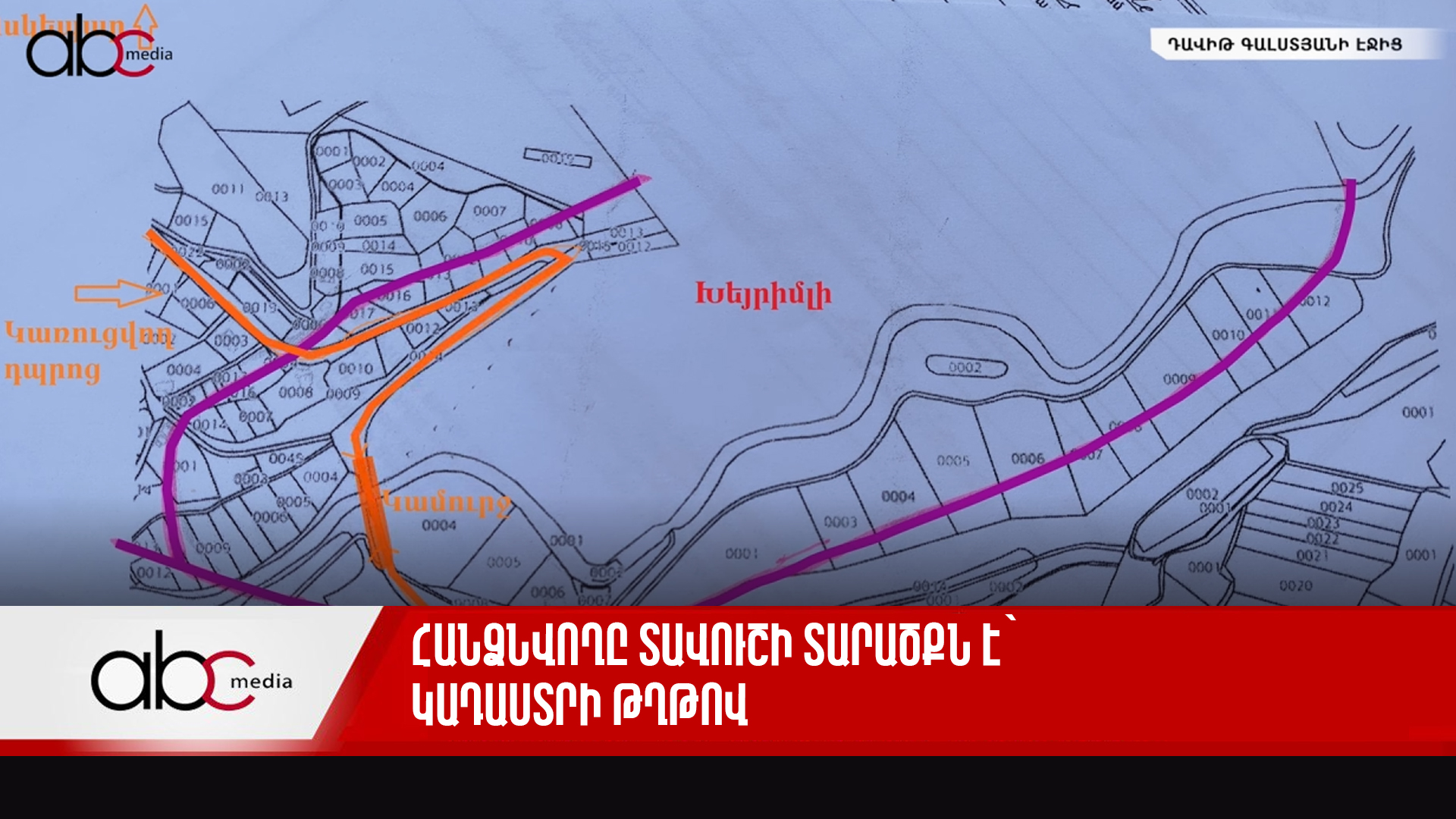
This is the territory of Tavush with its cadastre papers, now being ceded
According to Garnik Danielyan, this is the version of the cadastre map that the authorities presented to the residents of Kirants. The line marked in purple is the border with which, according to the authorities, border delimitation should be carried out. The territories marked with numbers are the property of the villagers. This is the Yerevan-Tbilisi highway; this is the bridge, which will completely come under Azerbaijani control; these are the houses that will be left to Azerbaijan. Look, this house is only 160 meters away from the school under construction. The house will be left to Azerbaijan, the school will not. Now let us look at the map and understand where the Soviet border actually was.


